 Add Row
  Add
Add 


The Ongoing Flood Advisory in Montana: Understanding the Risks
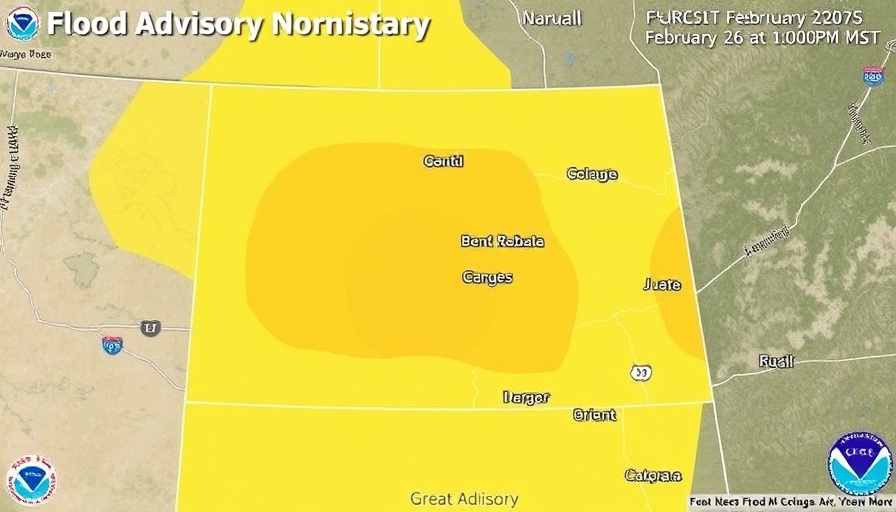
As warm temperatures and snowmelt converge, the National Weather Service has issued a flood advisory for central and north-central Montana, effective until 10 PM MST on February 26, 2025. This advisory, which applies to counties such as Cascade, Fergus, Judith Basin, and several others, signals the potential for flooding in low-lying areas, rural roadways, and agricultural fields due to excess water runoff.
What’s Causing the Flooding?
Recent temperatures in the region have propelled snowmelt at altitudes below 5,000 feet, creating conditions ripe for minor flooding. According to the NWS, significant snowfall in prior weeks, followed by the inflow of warm air, has compounded the risk of overflowing streams and creeks, especially near tributaries like Big Sandy Creek and Clear Creek.
The Impact on Local Residents
Reports of minor flooding have already surfaced, with emergency management officials indicating that poor drainage areas are overwhelmed. The flow of water over roadways poses a significant danger, leading the NWS to remind motorists of the critical safety rule: "Turn around, don't drown." Nighttime conditions can obscure dangers such as washed-out roads, making caution paramount.
Comparative Risks: Floods and Avalanches
As Montana experiences this flood advisory, a simultaneous avalanche warning also exists in northwest regions. Recent atmospheric conditions bring warm temperatures and precipitation, making the prospect of ice jams more likely. According to recent reports, areas ranging from Condon to Polebridge saw temperatures soar to nearly 50 degrees, a drastic shift that increases the likelihood of both flooding and avalanches, especially in winter sports areas.
Staying Prepared
To mitigate risks, residents are advised to clear their roofs and gutters, ensuring proper drainage and reducing flood risks from melting snow. Furthermore, officials recommend moving snow away from home foundations to improve water drainage. Such preparatory actions are essential in minimizing potential risks during this weather event.
Looking Ahead: Weather Patterns and Community Safety
As the advisory continues through the week, meteorologists are predicting a fluctuation in temperatures, with a potential drop leading to fresh snowfall. This combination of warm conditions followed by colder temperatures can lead to more unstable weather, necessitating vigilance among residents and travelers alike.
For the latest updates, community members should stay tuned to local weather reports and heed advisories from the National Weather Service. Stay safe, and remember that awareness and preparation are key in navigating these unpredictable weather patterns.


 Add Row
  Add
Add 
Write A Comment