 Add Row
  Add
Add 


Severe Thunderstorm Effects on Local Communities
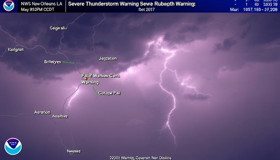
Residents in southeastern Louisiana are urged to take necessary precautions as a severe thunderstorm warning has been issued, enforcing an urgent response to potentially dangerous weather conditions. This warning, issued by the National Weather Service (NWS) in New Orleans at 9:32 PM CDT, is expected to last until 9:45 PM CDT and affects areas including West Feliciana, East Central Pointe Coupee, and parts of southwestern East Feliciana parishes.
Understanding Severe Thunderstorms: What to Expect
According to radar indications, these thunderstorms are currently moving northeast at 30 mph, accompanied by hazardous wind gusts reaching up to 60 mph and possible hail the size of pennies. The damaging winds pose a significant threat not only to crops and property but also to the trees that provide shade and beauty in communities impacted.
Protecting Your Property During Severe Weather
Residents are advised to move to an interior room on the lowest floor of their homes or offices to avoid injury from flying debris. Wind gusts of this magnitude can result in fallen trees and structural damage, underscoring the necessity for swift action and preparedness.
Communicating During Storms: The Importance of Staying Informed
Staying updated on weather conditions through alerts and warnings can significantly mitigate risk during severe weather events. The NWS provides real-time updates, and local communities should encourage a culture of preparedness, sharing vital weather information through teamwork and communication.
After the Storm: Assessing the Impact on Local Wildlife and Forestry
The aftermath of severe thunderstorms can leave a lasting impact on local ecosystems. Hail and heavy winds can damage trees, disrupt wildlife habitats, and affect the natural beauty of the region. Communities may need to engage in recovery plans to address tree care and restoration after severe weather events.

 Add Row
  Add
Add 
Write A Comment